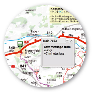
Using the timetable and the current operational status (positioning) as a basis, the dispatching module provides a comprehensive overview of all operational vehicles and vehicles scheduled for that day in the form of time-distance-line diagrams, charts, on the geographical map and on route maps.
To allow for a variance comparison, the starting point for each dispatch is the exact location of the vehicles. The positioning information can come from various sources such as GPS, external systems like LeiDis, ILTIS or BBR and is processed in DiLoc.
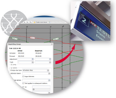
The key work tools when it comes to dispatching are the freely configurable time-distance-line diagrams. These diagrams are used to enter any scheduling changes such as delays, train cancellations, replacement services and to amend any vulnerable connections on the basis of the automatic forecast calculation.
Any systems that may be connected such as, for example, the passenger information service and other transportation companies in the area (via Association of German
Transport Companies etc.) are provided with information on the current operational status and sent disruption notifications automatically by way of interfaces.